
Overview

Most research of interdependent critical infrastructures to date are usually modeled at a single spatial level, e.g. component or system level. Besides, it is common for current studies to assume that the disaster occurs in one analysis step, i.e. nearly instantaneously. These limitations are owing to the difficulty of integrating simulators with multiple spatial and temporal scales.
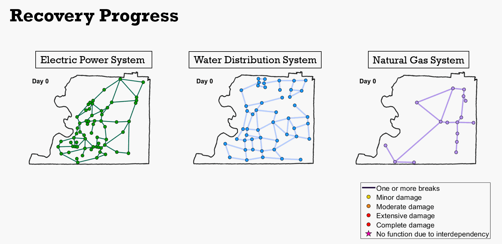
This research focuses on the multi-scale resilience assessment of interdependent lifeline systems subjected to subsequent hazards. A time-dependent analysis of different disaster stages and the succeeding recovery process is conduced considering multi-scale interdependence in a community.
Framework
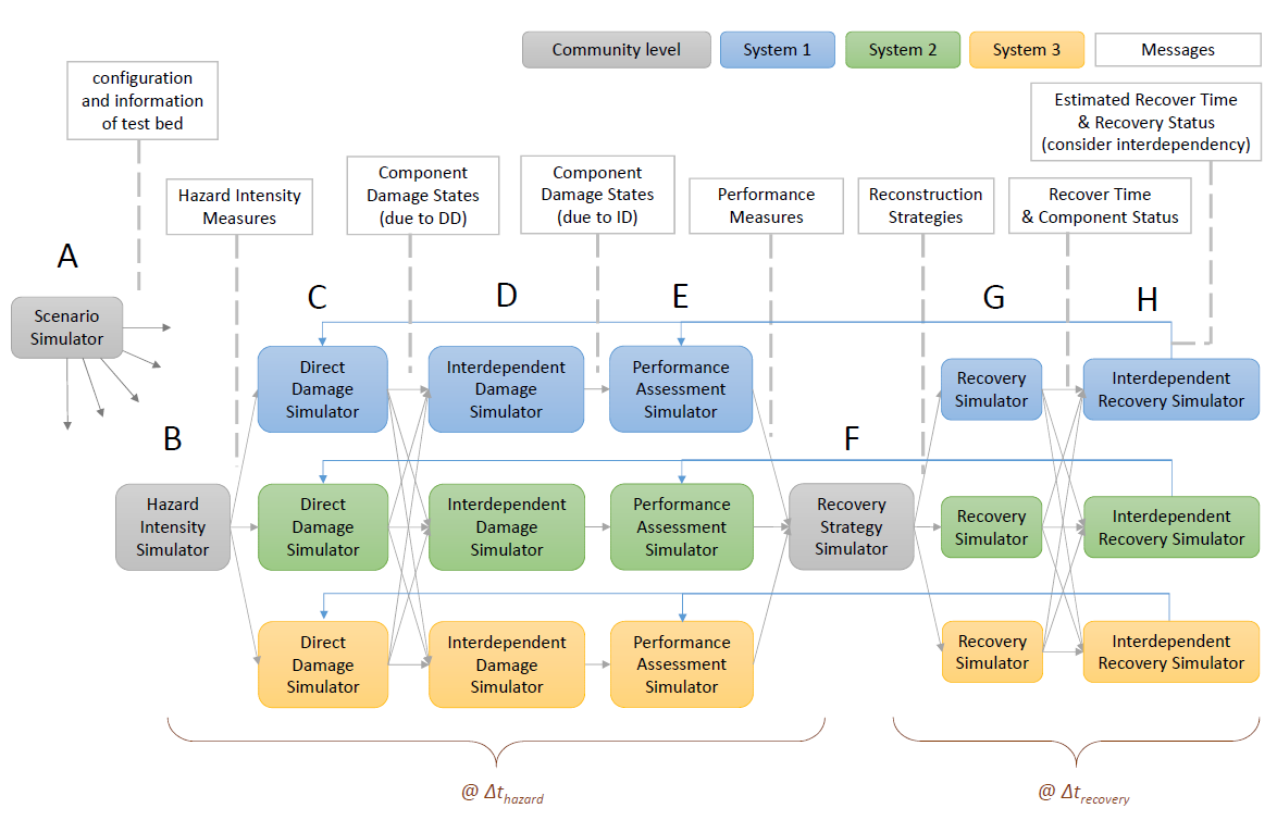
A distributed computational framework is proposed for assessing seismic damage and restoration of lifeline systems that involves to subsequent hazards. The simulators with multiple spatial and temporal scales interact and communicate together through a publish-subscribe data transmit pattern. A time-dependent analysis of the different phases of a hazard and the subsequent recovery process can be conducted.
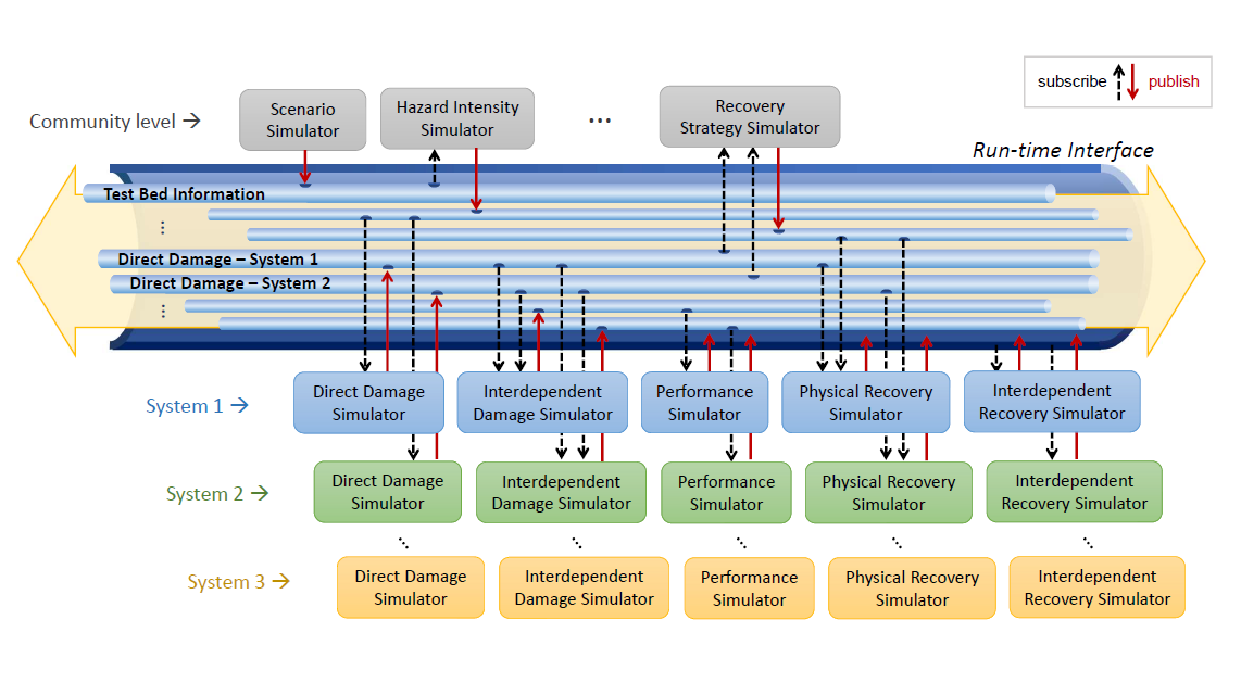
Publish-Subscribe Data Transmit Pattern
Team:
Szu-Yun Lin, Dr. Sherif El-Tawil
Downloads:
TBA
This project is supported by the United States National Science Foundation (NSF) through grant 1638186 (CRISP Type 2: Interdependencies in Community Resilience (ICoR): A Simulation Framework). Any opinions, findings, conclusions, and recommendations expressed on this site are those of the project team members and do not necessarily reflect the views of the NSF.